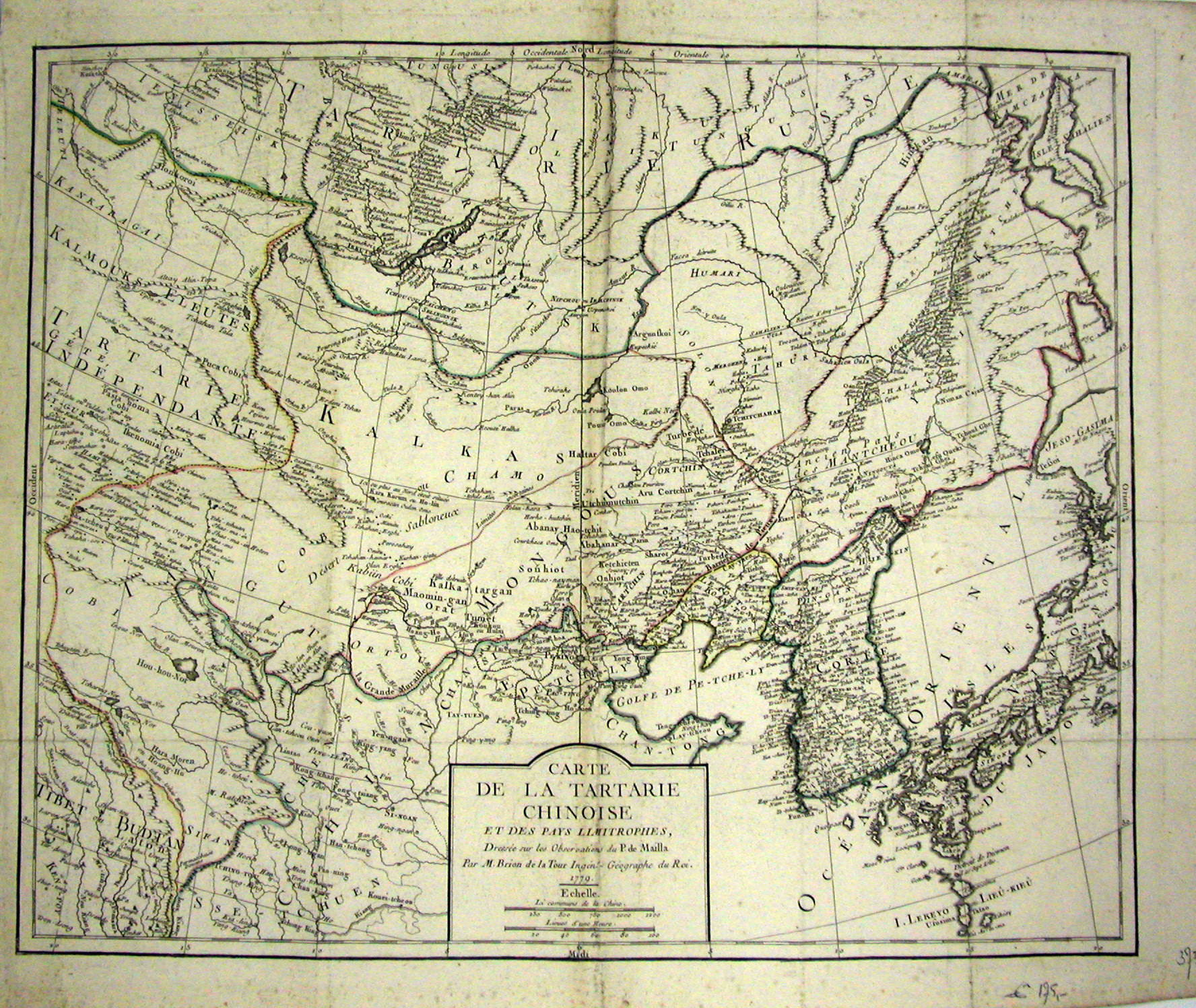
Carte de la Tartarie Chinoise [French]
Map of Chinese Tartary [translation] et des pays limitrophes [French]
and of the neighboring countries [translation]
Dressee sur les Observations du P. de Mailla [French] Mapped on the observations of P. du Mailla [translation] par M. Brion de la Tour Ingen. Geographe du Roy [French] by M. Brion de la Tour, cartographer of the king. [translation] LOUIS BRION DE LA TOUR 1756-1803 Beyond the fact that Brion de Ia Tour was an engineer by profession and held the post of Ingenieur-Geographe du Roi, little is known of his career. He published a wide range of statistical works and a number of atlases, of which the following are the most important: * 1756 Cartes des Places Fortes et des Principaux Ports des Isles Britanniques * 1757 Cotes Maritimes de France * 1766 Atlas Itineraire Portatif (8vo) * 1766 Atlas General 1776, 1786 Re-issued * 1795 Description generale de l'Europe etc (4to) * 1803 Atlas geographique et statistique de la France (4to) This map is clearly based on the work of Jean Baptiste Bourguignon d'Anville (1697-1782) and that makes this map an Anville type. |