|
|
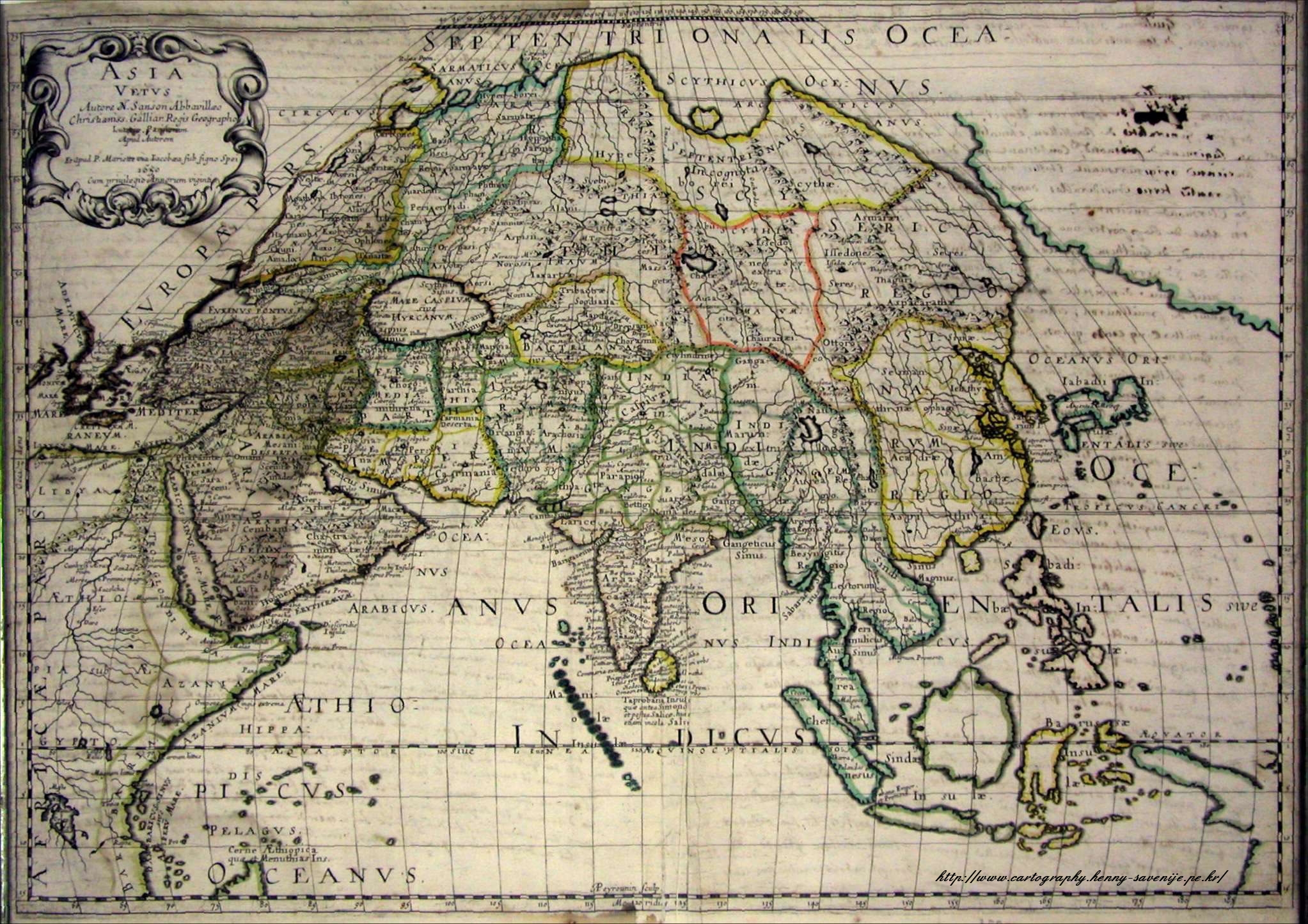
Asia Vetus N. Sanson Abbavillaeo Christianiss. Galliar. Regis Geographo. Lut[....] Parisiis Apud Auctorem Et Apud Petrum Mariette via Iacobaea sub signo spei. 1650. Cum Privilegio Annorum Viginti. [Latin] Old Asia, Cartographer: Nicolas d'Abbeville Sanson, [1600-1667] Royal Geographer At Paris by the author and by Pierre Mariette, rue S. Iacques a l'Esperiance [address] 1650 at the benefit of the 20th anniversary of the king. [translation]
Sanson’s influence was far-reaching and long lasting. His relationship with Louis XIV resulted in strong patronage of French geographers and mapmakers by the long-lived monarch. Sanson’s teaching skills not only included the king, but also members of the prominent Del’Isle family, who established map houses in the late seventeenth and early eighteenth centuries. The teacher-geographer-mapmaker also passed his knowledge to his three sons, Nicolas, Adrian, and Guillaume, as well as a nephew, Gilles Robert de Vaugondy, and grandson, Pierre Moulard-Sanson. All came into the family business and the firm flourished for almost a hundred years. Korea is depicted as a Janssonius type, meaning that the Dutch cartographer Janssonius used this type the first. NICOLAS SANSON (father) 1600-67 NICOLAS SANSON (son) 1626-48 GUILLAUME SANSON (son) -d. 1703 ADRIEN SANSON (son) -d. 1708 PIERRE MOULARD-SANSON (grandson) -d. 1730 Sanson was born in Abbeville where as a young man he studied history, particularly of the ancient world, and it is said that he turned to cartography only as a means of illustrating his historical work. For this purpose he prepared a number of beautifully drawn maps, one of which, after his move to Paris, came to the attention of Louis XIII. In due course the King appointed him 'Geographe Ordinaire du Roi', one of his duties being to tutor the King in geography. In the preparation of his major atlas, Cartes Generales de Toutes les Parties du Monde, Sanson employed a number of engravers, one of whom, M. Tavernier, engraved important maps showing the Post Roads and River and Waterway system of France (1632-34) and a map of the British Isles (1640). In all, Sanson produced about 300 maps of which two of North America were particularly influential: Amerique Septentrionale (1650) and Le Canada ou Nouvelte France (1656), the first map to show all the Great Lakes. After Sanson's death the business was carried on by his two surviving sons and grandson, in partnership with A. H. Jaillot. |